


Raymond Township Voting District, Rice County, Kansas
About
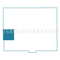
Outline

Summary
| Unique Area Identifier | 586486 |
| Name | Raymond Township Voting District |
| County | Rice County |
| State | Kansas |
| Area (square miles) | 35.93 |
| Land Area (square miles) | 35.63 |
| Water Area (square miles) | 0.30 |
| % of Land Area | 99.18 |
| % of Water Area | 0.82 |
| Latitude of the Internal Point | 38.31122690 |
| Longtitude of the Internal Point | -98.41531340 |
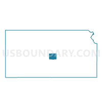
Maps

Graphs
Select a template below for downloading or customizing gragh for Raymond Township Voting District, Rice County, Kansas


Neighbors
Neighoring Voting District (by Name) Neighboring Voting District on the Map
- Bell Township Voting District, Rice County, KS
- Center Township Voting District, Rice County, KS
- Comanche Township Voting District, Barton County, KS
- Lakin Township Voting District, Barton County, KS
- Lincoln Township Voting District, Rice County, KS
- Pioneer Township Voting District, Rice County, KS
- Putnam Township Voting District, Stafford County, KS
Top 10 Neighboring County Subdivision (by Population) Neighboring County Subdivision on the Map
- Lincoln township, Rice County, KS (563)
- Comanche township, Barton County, KS (462)
- Lakin township, Barton County, KS (262)
- Raymond township, Rice County, KS (153)
- Center township, Rice County, KS (131)
- Pioneer township, Rice County, KS (72)
- Putnam township, Stafford County, KS (24)
- Bell township, Rice County, KS (10)
Top 10 Neighboring Place (by Population) Neighboring Place on the Map
Top 10 Neighboring Unified School District (by Population) Neighboring Unified School District on the Map
- Sterling Unified School District 376, KS (3,123)
- Ellinwood Public Schools Unified School District 355, KS (2,885)
- Chase-Raymond Unified School District 401, KS (896)
Top 10 Neighboring State Legislative District Lower Chamber (by Population) Neighboring State Legislative District Lower Chamber on the Map
- State House District 114, KS (21,602)
- State House District 112, KS (20,797)
- State House District 113, KS (18,946)
Top 10 Neighboring State Legislative District Upper Chamber (by Population) Neighboring State Legislative District Upper Chamber on the Map
Top 10 Neighboring 111th Congressional District (by Population) Neighboring 111th Congressional District on the Map
Top 10 Neighboring Census Tract (by Population) Neighboring Census Tract on the Map
- Census Tract 9711, Barton County, KS (3,971)
- Census Tract 9673, Rice County, KS (3,678)
- Census Tract 9671, Rice County, KS (2,496)
- Census Tract 4706, Stafford County, KS (2,012)